Cross Island Line
Our eighth MRT line, the Cross Island Line (CRL) will be our longest fully underground line at more than 50 kilometres long. It will serve existing and future developments in the eastern, western, and north-eastern corridors, connecting major hubs such as Jurong Lake District, Punggol Digital District and Changi region.
When operational, it will have eight (8) interchange stations. This means more alternative travel routes to get to your destination.
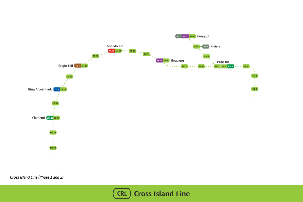
Constructed in three phases, the 29-kilometre long Phase 1 of the CRL (CRL1) will comprise twelve (12) stations from CR2 station to CR13 Bright Hill interchange station. This will serve residential and industrial areas such as Loyang, Tampines, Pasir Ris, Defu, Hougang, Serangoon North and Ang Mo Kio. More than 100,000 households will benefit from CRL1, and common recreational spaces such as Changi Beach Park and Bishan-Ang Mo Kio Park will also become accessible by public transport. Construction for CRL1 has commenced and is targeted to be completed by 2030.
Phase 2 of the CRL (CRL2) is approximately 15 kilometres and comprises six (6) underground stations. The Environmental Impact Study for CRL2 have been completed and the reports are available for public feedback.
The 7.3-kilometre CRL – Punggol Extension will provide a direct link for commuters travelling between eastern areas such as Pasir Ris and Tampines North, and north-eastern areas such as Punggol and Sengkang.
Construction for CRL – Punggol Extension has commenced and is targeted to be completed by 2032.
Latest Updates
CRL2 will provide greater accessibility for those living in the west, including areas such as Sunset Way and West Coast that are not currently served by an MRT line. Two of the six stations will be interchange stations, with King Albert Park station connecting commuters to the Downtown Line, and Clementi station to the East-West Line.
With the improved connectivity, CRL2 will shorten travel times for commuters travelling to and from the western parts of Singapore. Together with the CRL1 and CRL – Punggol Extension, CRL will offer alternative travel options for commuters and help to redistribute commuter load across Singapore’s entire rail network.
Construction works for CRL2 are progressing well, with the stations opening by 2032.
Alignment Options for CRL
To allow an informed decision on the alignment for the stretch of the Cross Island Line in the vicinity of the Central Catchment Nature Reserve (CCNR) to be made by the government, LTA had appointed an internationally-acclaimed consultant to conduct a comprehensive two-phased EIA and involving multiple stakeholders including the nature groups, heritage groups, residents and grassroots leaders.
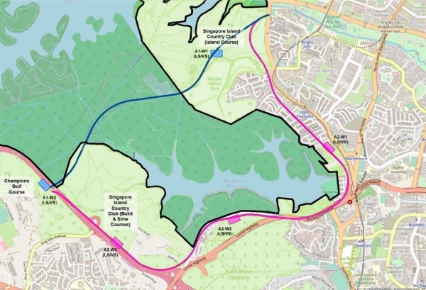
Above: Direct (blue line) and Skirting (pink line) alignment options. CCNR boundary marked by black line
Two-phase EIA Process
Phase 1 evaluated the existing ecosystem and physical conditions of the CCNR as well as the environmental impact of site investigation (SI) works within the CCNR. Phase 1 had been completed with the report gazetted and published on the LTA website in 2016. The findings of the SI works (carried out following the report) were used to inform Phase 2 of the EIA.
Phase 2 zoomed into the potential environmental impact of the construction and operations of the CRL as well as the required mitigation measures. LTA sought inputs from, and engaged with, the relevant stakeholders as part of this process. This phase of the EIA has recently been completed and a comprehensive report on its findings was published. Extensive consultations are being held to consider all views and issues, including the environmental impact, length of commute, engineering feasibility, disruptions to businesses and families, as well as the cost to taxpayers.
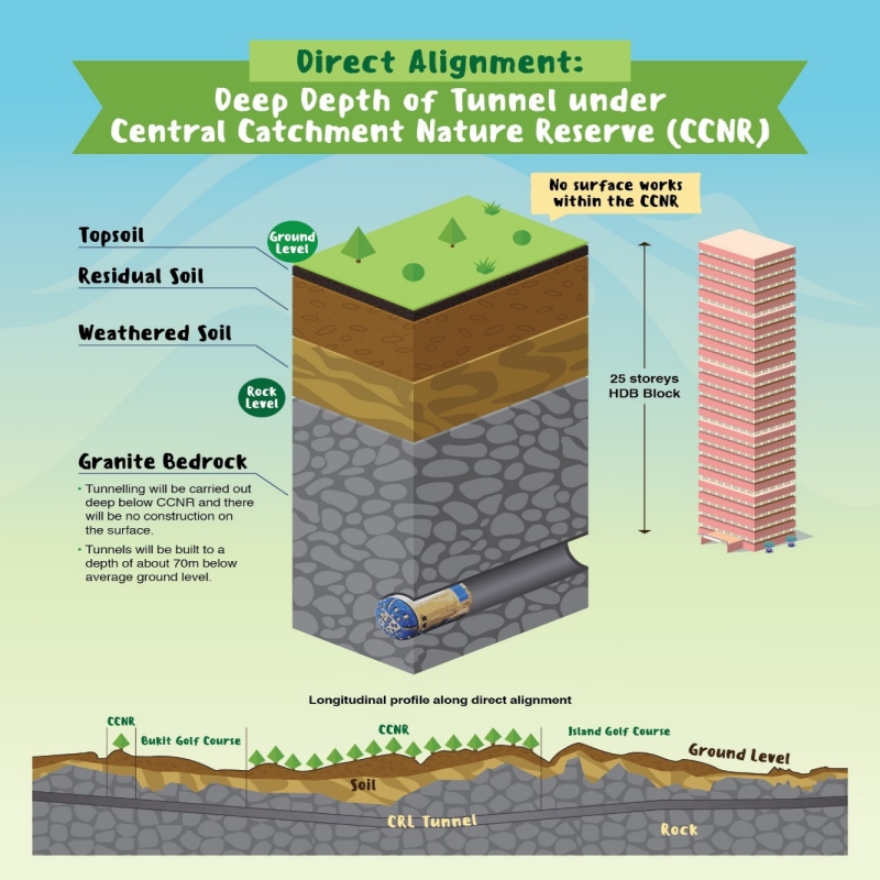
- 2km tunnel beneath the CCNR, 2km outside it
- Approximately 70m deep or the height of a 25-storeys HDB flat
- Tunneling will be done fully in hard granite rock
- No physical structure on the surface level within the CCNR
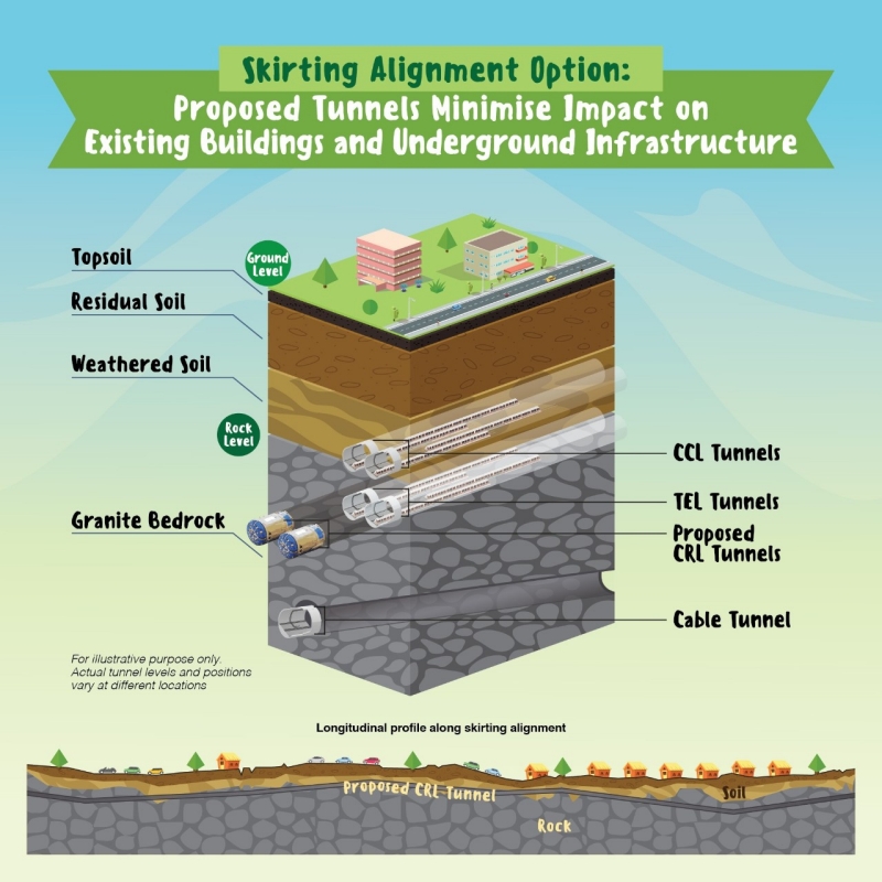
- Does not cross under the CCNR, skirts around (and away) from CCNR
- Approximately 45m deep to ensure that tunneling will be safe for buildings and away from existing underground infrastructure along this alignment
- 9km tunnel route length under roads as well as residential and commercial buildings
- About 6 minutes less commuting time under the direct alignment between any two CRL stations on either sides of the CCNR.
- About 15% less per trip for commuter fare on average under the direct alignment.
- Estimated daily ridership of more than 600,000 across the whole CRL in the initial years, and over one million in the longer term, under the direct alignment. This will be lower under the skirting alignment as some commuters are expected to remain on the existing lines.
Environmental Study Report for Cross Island Line CCNR Alignment Options
Engineering Schemes
LTA have devised robust engineering schemes for the two alignments. These schemes define the geographical focus and construction techniques to be adopted that informed the EIA. The engineering schemes are robust and independently reviewed by LTA’s International Panel of Advisors (IPA)[1]. The IPA comprises internationally renowned experts in geotechnical and tunnel engineering, who concluded that with control measures in place, tunnelling along either alignment option is safe.
The EIA, by Environmental Resource Management (S) Pte Ltd (ERM), was rigorously undertaken based on an internationally-recognised framework and relevant authoritative references[2]. ERM is a global specialist in environmental, social, health, safety and risk management consulting services that have done similar EIA works in the UK, China and Hong Kong. The EIA Report, too, was independently reviewed by an appointed consultant[3].
Key points of Environmental Study Report for the Alignment Options for CCNR
- The EIA was commissioned by LTA, and conducted by ERM, to aid decision-making on the alignment options as part of a rigorous process of understanding the environmental impact.
- Based on the EIA, both underground alignments are feasible. The residual impacts for the factors studied are largely moderate or below. Moderate impact indicates small effects that are around existing conditions and/or within accepted standards.
- All EIA impacts are largely confined to the worksites outside the CCNR and the tunnel alignments that run deep underground beneath the CCNR (for the direct alignment option) or around it (for the skirting alignment option).
- LTA is committed to undertake all necessary mitigation measures to minimise potential environmental impact.
[1] The members to the IPA are appointed on a two-yearly basis by LTA. For the 2017-2019 term, the IPA was chaired by Prof Yong Kwet Yew (Singapore), NUS Senior Vice President and Professor of Civil Engineering, whilst the other IPA members included Mr John Busbridge from Canada, Ex-President Golder Associates on Global Operations; Mr Eddie Woods from the United Kingdom, Tunnel Discipline Lead for UK High Speed 2 and ex-Chief Engineer Thames Tideway Tunnel; Prof Lee In-Mo from Korea University, Director of Institute of Underground Space Technology and ex-President of International Tunnelling Association; Mr Tadashi Hashimoto from the Director of Geo-Research Institute in Japan and Overseas Expert of Science and Technology committee to Shanghai Municipal Commission.
[2] The biodiversity assessment for the Environmental Study Report for the Alignment Options for CCNR took into account the international standards set out in the International Finance Corporation (IFC) Performance Standard/Biodiversity Offsets and accompanying materials.
[3] Mr. Tony O'Dempsey was engaged by LTA as the independent reviewer for the Environmental Study Report for the Alignment Options for CCNR. He was also the independent environmental consultant in Phase 1 site investigation works inside the CCNR. Tony has been working as a volunteer on various conservation projects relating to the Nature Reserves for the past 20 years and is very familiar with the forest habitats of the CCNR. An active member in the Nature Society of Singapore (NSS), he has held various positions in the past, including council member of NSS and chair of its vertebrate study group. He is a professional who has been working in the Geographic Information System (GIS) industry in Singapore for 25 years and has applied his GIS and cartography skills to the various conservation projects he has worked on. He has a Bachelor Applied Science (Surveying) from Queensland University of Technology.
Location of Stations
Phase 1, 2030: Sparking New Journeys
Stations: 12 stations
Interchanges: Pasir Ris (EWL), Hougang (NEL), Ang Mo Kio (NSL) and Bright Hill (TEL)
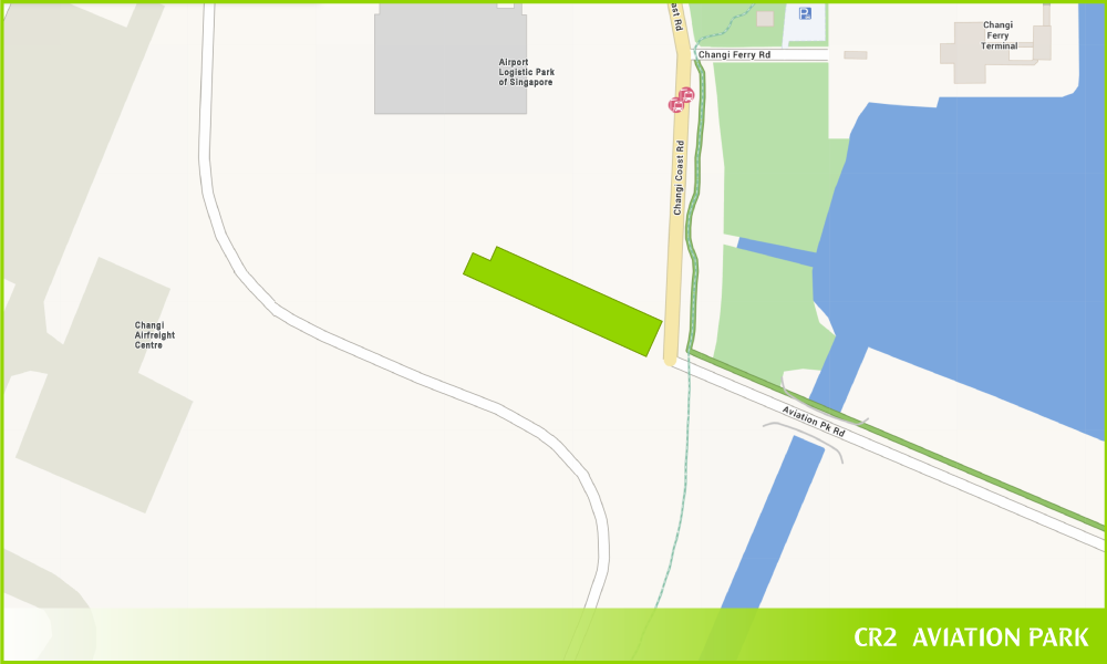
CR2 Station
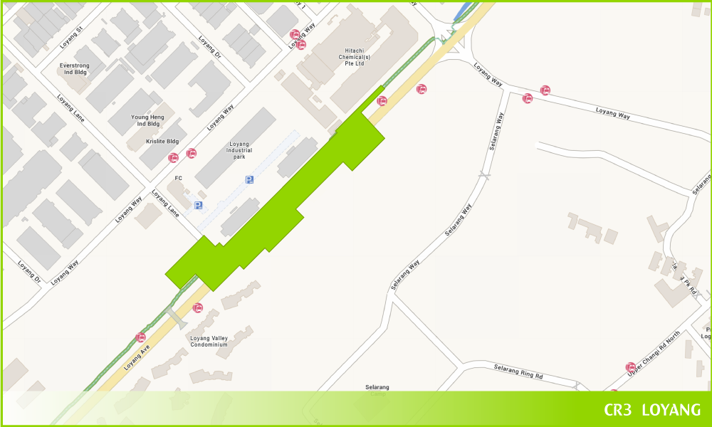
CR3 Station
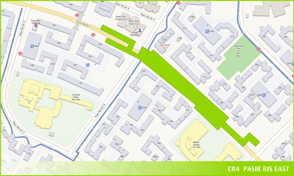
CR4 Station
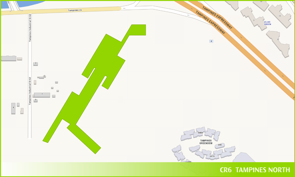
CR6 Station
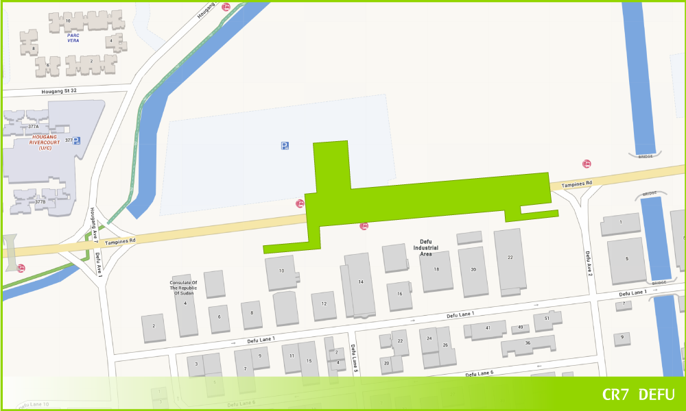
CR7 Station
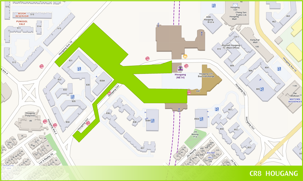
Hougang
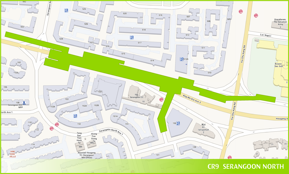
CR9 Station
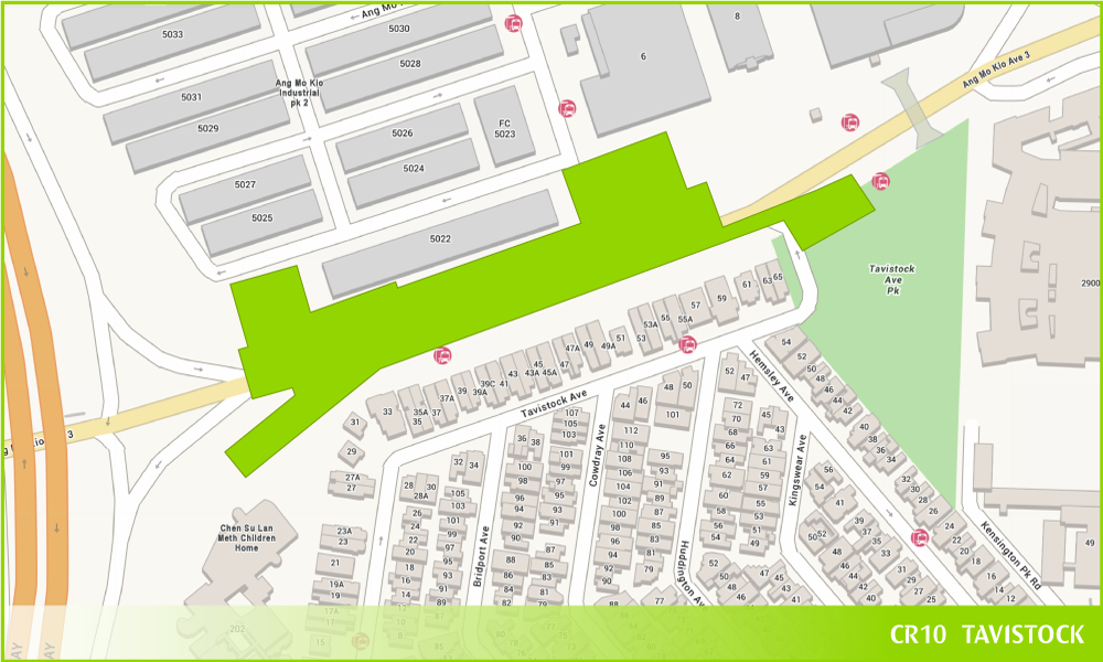
CR10 Station
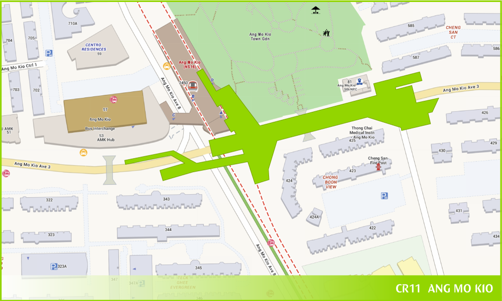
Ang Mo Kio
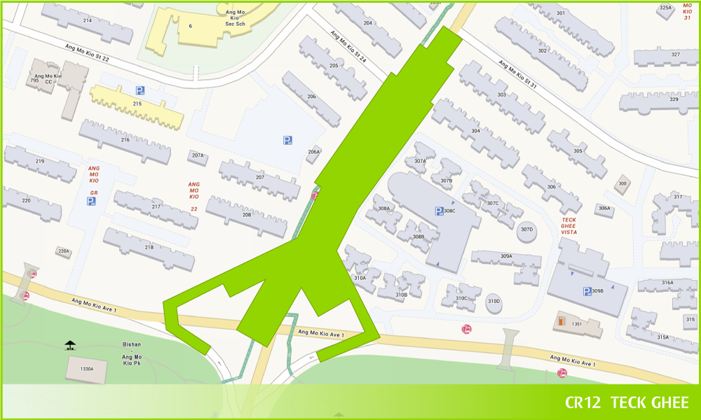
CR12 Station
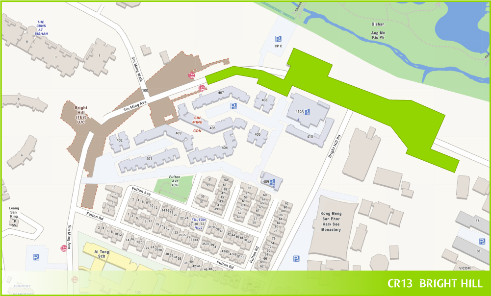
Bright Hill
CRL – Punggol Extension, 2032: Building Closer Connections
Stations: 4 stations
Interchanges: Pasir Ris (EWL), Riviera LRT and Punggol (NEL)
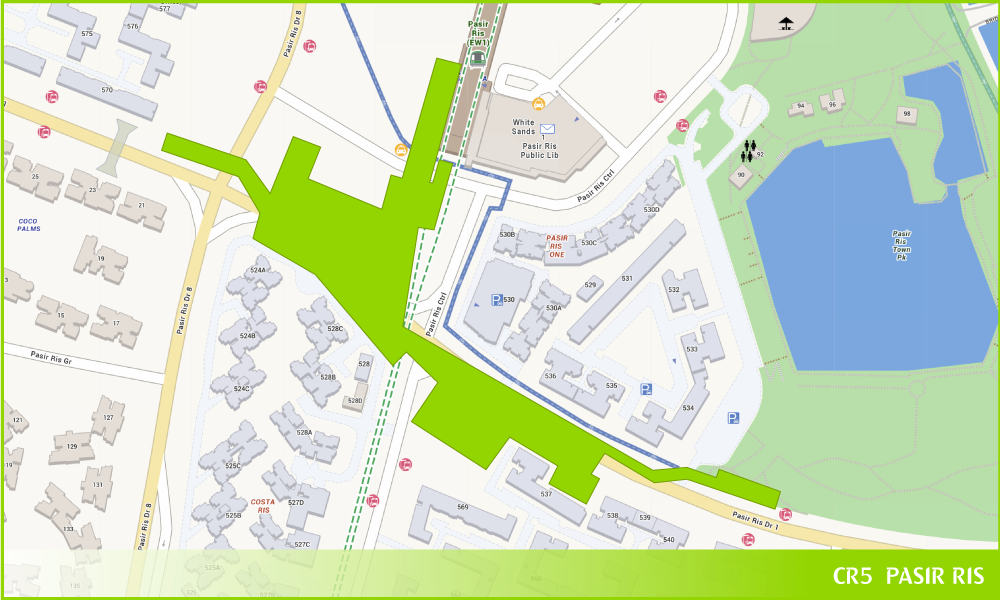
Pasir Ris
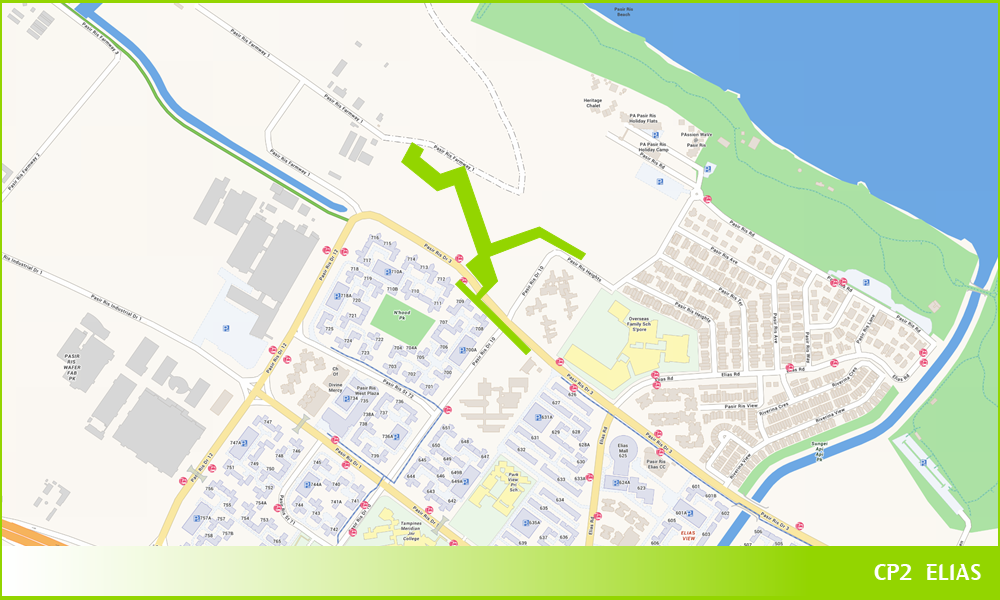
CP2 Station
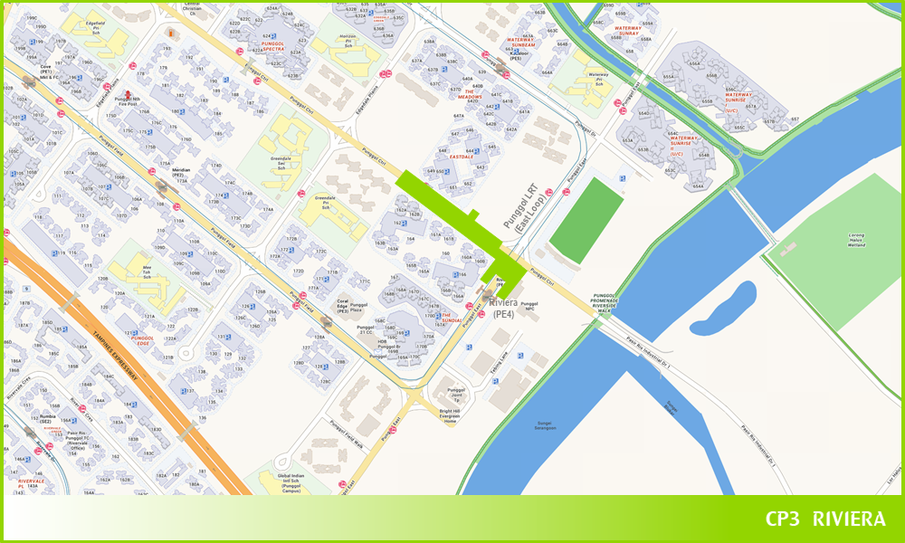
Riviera
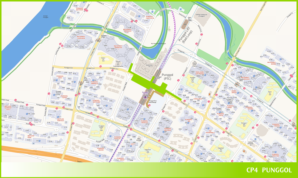
Punggol
Phase 2, 2032: Discovering New Moments
Stations: 6 stations
Interchanges: Clementi (EWL) and King Albert Park (DTL)
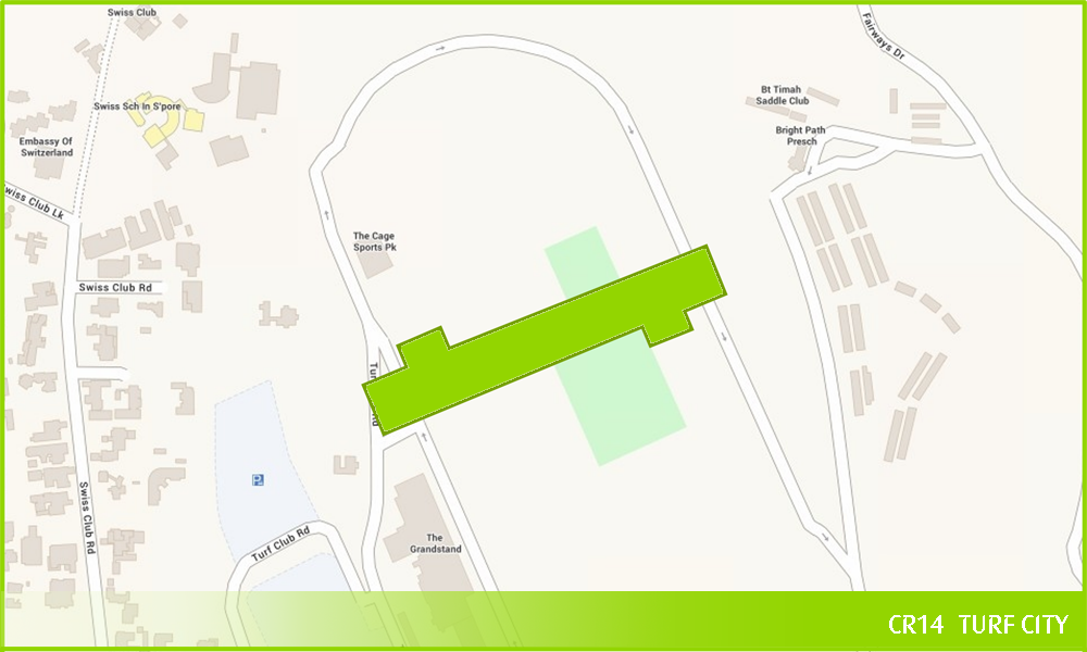
CR14 Station
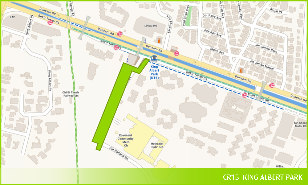
King Albert Park
.png)
CR16 Station
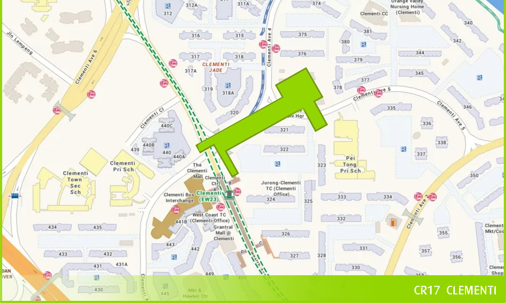
Clementi
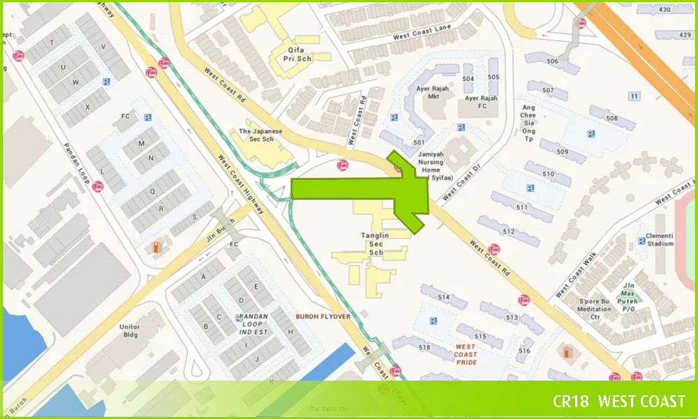
CR18 Station
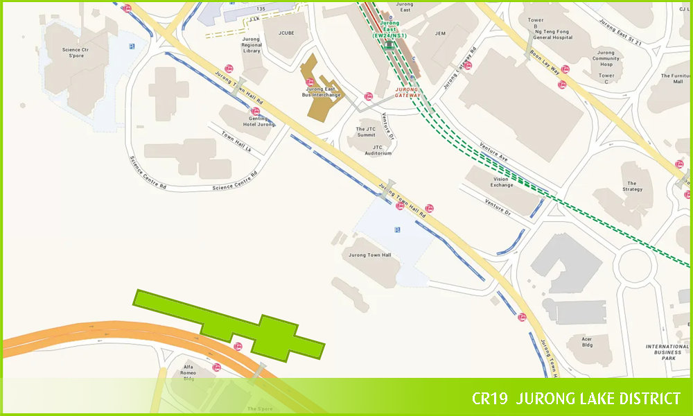
CR19 Station
Key Facts (CRL Phases 1, 2 and CRL-Punggol Extension)

Number of stations
21

Length of line
50+km

Expected completion
2032
News Releases
Joint News Release by the Land Transport Authority (LTA) & SLA - Cross Island Line 1: New Links by 2029
Environmental Impact Assessment (Phase 2) Report
Cross Island Line – Punggol Extension: Better Rail Connectivity for Punggol and Pasir Ris Residents