Facebook Pixel

Cycling

A connected cycling-friendly city
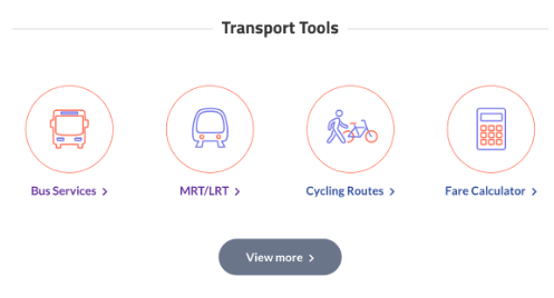
At the national level, there are now 525km of cycling paths, and we will expand the cycling path network to around 1300km by 2030. These cycling paths will connect commuters from their homes to MRT stations, bus interchanges and nearby shopping malls and schools.

Cycling Path Networks

Cycling Path Networks (CPNs) introduce infrastructural upgrades designed to provide a safe and conducive environment for active mobility users of different ages and proficiency levels to commute around towns with greater ease and convenience.

Today, we have cycling path networks in nine HDB towns (PDF, 10kB), and will be building more in six towns as well as expanding the existing CPNs at Ang Mo Kio and Tampines by 2024. Residents staying in Tampines town can look forward to additional routes connecting to neighbouring towns and Changi Business Park.

Improvement to the east-west inter-town cycling connectivity will also be carried out by linking up Queenstown to the City via the Alexandra Park Connector, and linking Geylang to the City via the Geylang Park Connector. To facilitate cycling within the Central Area, we will be providing more cycling paths to connect residents and workers to and from MRT stations and bus stops in the city.

#ExploreSG on your bike 

Rediscover Singapore with fresh eyes and create your own bike expedition! Plan your expedition with a series of #ExploreSGRide cycling routes we have curated for you to explore while staying active and healthy. These routes feature scenic views and bring you through iconic landmarks in Singapore; some of which you may not even know exist! Remember to familiarise yourself with the rules and Code of Conduct before you explore!

lone_admiralty_coney

Visit the Lone Tree at the Jurong Lake District, Admiralty Park Playground featuring one of the longest and tallest tube slides in Singapore, Coney Island and more when you try our #ExploreSGRide cycling routes.

If you love nature, consider exploring the forest and mangrove habitats at Admiralty Park in our Woodlands route, or enjoy the sea breeze as you cycle along the long coastline in our Pasir Ris – Changi route. Opt for the Marina Bay – Rochor route to enjoy the Singapore’s city skyline as you cycle!

What are you waiting for? Pick a cycling route below, and go on a #ExploreSGRide adventure with your family and friends:

  1. Ang Mo Kio - Lornie (PDF, 762kB)
  2. Bedok - Tampines (PDF, 506kB)
  3. Bukit Gombak - Bukit Panjang (PDF, 326kB)
  4. Geylang - Marine Parade (PDF, 418kB)
  5. Jurong (PDF, 430kB)
  6. Marina Bay - Rochor (PDF, 492kB)
  7. Pasir Ris - Changi (PDF, 278kB)
  8. Punggol - Sengkang (PDF, 2.0MB)
  9. Woodlands (PDF, 2.0MB)
  10. Yishun (PDF, 1.6MB)

Cycling Friendly Features

Beyond building cycling links that connect MRT stations to park connectors for cyclists to have easier and safer first-and-last-mile commutes, we are also building other cycling infrastructure, such as parking spaces, that will also be improved for safety and convenience.

Here are some examples of our cycling path networks.


Singapore’s first walking and cycling town, Ang Mo Kio features a 4km cycling network linking residents to Ang Mo Kio MRT station and bus interchange. This makes it safe and seamless for them to cycle or walk the first and last mile for their daily commute. The network has also improved access to landmarks such as the Ang Mo Kio Swimming Complex and AMK Hub.

The first phase of this project, which loops around Ang Mo Kio Ave 1, 3 and 8, was completed in July 2016. Ongoing works for Phase 2 are expected to be completed by 2022, and will extend the system of cycling paths to 20km – the longest for any residential town.

Why Ang Mo Kio?

As a mature town, Ang Mo Kio was chosen to test innovative solutions that support walking and cycling in a built-up environment. These included new planning typologies, junction design, harmonised signage, and innovative elevated infrastructure for walking and cycling.

Special features

Some of the special features includes:    

Sheltered cycling path lined with greenery

Sheltered cycling path lined with greenery

Distinctive Red Cycling Paths

Distinctive Red Cycling Paths

Pedestrian priority zones to improve safety by clearly marking out where pedestrians and cyclists should travel.

Pedestrian priority zones are created in areas where pedestrians and cyclists need to share the space, such as spaces behind bus stops and road crossings.

Bicycle wheeling ramps along staircases

Bicycle wheeling ramps along staircases

Easy-to-read maps on signboards
  • Converting the space under the MRT viaduct into a sheltered cycling path lined with greenery. It is also a test bed for new horticultural technology, thanks to LTA’s partnership with the National Parks Board;
  • Distinctive red cycling paths;
  • Pedestrian Priority Zones to improve safety by clearly marking out where pedestrians and cyclists should travel;
  • Bicycle wheeling ramps along staircases;
  • Easy-to-read maps on signboards


Future Plans

Plans have been put in place to provide a direct cycling route from the city to towns such as Queenstown, Geylang and those along the North-South Corridor including Yishun and Sembawang.

Cycling paths in Bencoolen Street

Commuters along Bencoolen Street can now enjoy a smoother and safer experience while walking or cycling, after transforming two of the four original vehicular lanes into widened walkways and cycling lanes, as part of LTA’s Walk Cycle Ride SG initiative.

This took place while the street was closed off during the construction of the Downtown Line’s Bencoolen station, and LTA and other government agencies saw the opportunity to “pedestrianise” the street and reclaim road spaces for people-centric activities.

Key features of the people-centric street include:

  • Wider footpaths lined with trees that provide shade, as well as benches for pedestrians to pause and relax
  • A dedicated cycling path that connects to the rest of the city and other parts of Singapore, as part of the Central Area Cycling Network (PDF, 1MB)
  • More than 125 bicycle parking spaces
  • A dedicated bus lane for faster and smoother bus journeys
More bicycle parking spaces in Bencoolen

More than 125 bicycle parking

Dedicated bus lane

A dedicated bus lane for faster and smoother bus journeys

Besides Bencoolen, other areas in the city – including Coleman Street, Armenian Street and Waterloo Street – will also be transformed into car-lite areas by 2020. This means we can look forward to a more walkable and people-friendly Civic District. 

Cyclists along Tanah Merah Coast on-road cycling lane

A popular route for sports cyclists, the 10km cycling lane along Tanah Merah Coast Road is a one-way cycling infrastructure that features new markings and elements to enhance cyclists’ safety on a stretch that is often piled by heavy vehicles. For more information about the cycling lane, please refer to the following PDF (PDF, 1.2mb). For safe cycling practices, please refer to this page. Casual cyclists who are not confident in cycling on the road may consider using the Park Connector Network (PCN) running alongside Tanah Merah Coast Road.

Sunday_Cycling_Lane_Trial

In Oct 2022, LTA kickstarted the West Camp Road Sunday Cycling Lane trial, which sets aside dedicated road space along West Camp Road for cyclists to ride during hours when vehicular traffic is low.

The cycling lane trial has been introduced for a period of 6 months until April 2023, and will be operational every Sunday morning from 5am to 11am. During operating hours, only buses and cyclists are allowed in the cycling lane. Cyclists will also not be subject to the group size limit during operating hours.

The 4.6km cycling lane is demarcated by solid blue lane markings and "Lane begins" and "Lane ends" signboards to demarcate the start and end point of the cycling lane. The operational hours are indicated via prominent road signs and road surface markings.  

LTA will use the trial to gather feedback from users and assess the impact on road traffic before finalising future plans.

For more information about the Sunday Cycling Lane Trial at West Camp Road, please refer to the Sunday Cycling Lane Poster (PDF, 238kB) and Sunday Cycling Lane Leaflet (PDF, 1.1MB). For general safe cycling practices, please refer to the Rules and Code of Conduct page.

Bicycle parking facilities

Together with our partner agencies, we have provided over 220,000 public bicycle parking lots at public transport nodes, public housing void decks and public parks, so cyclists can easily find a convenient place to park. More than 47,000 lots are targeted to be implemented by the end of 2020, bringing the total number to 267,000. Today, most residential areas and transport nodes are within a 5-minute walk to a parking facility.

A lane for cyclists at traffic junctions

Dedicated bicycle crossings (PDF, 158kb) have been built at 38 pedestrian crossings which improved safety by separating cyclists from pedestrians.

Bicycle wheeling ramps along staircases

Since 2013, bicycle wheeling ramps have been installed at various  locations to enable cyclists to push their bicycles across pedestrian overhead bridges without the need to carry them.

How to use the Bicycle Wheeling Ramp (BWR)

Loading bike onto bicycle wheeling ramp

Loading Bike: Tilt the bicycle slightly towards your body to keep the pedal away from the railings.

Going down the bicycle wheeling ramp
Going Down: Place both hands on the handle bar and be prepared to apply brakes when necessary.
Going up onto bicycle wheeling ramp
Going Up: Push your bicycle up the BWR by holding onto the handle bar and seat.

To enhance the safety for all commuters, we will be implementing safety markings at selected bus stops. These markings will remind active mobility device users to slow down and give way to commuters boarding and alighting from buses.

The safety markings includes:

  • Guiding lines to direct active mobility device users;
  • “SLOW” markings; and
  • Speed regulating strips

Where there is available space behind the bus stop, active mobility device users are advised to follow the guiding lines instead of riding through the bus stop.

Such safety features at bus stops will be rolled out where necessary and feasible.


Examples of safety markings:

Guiding lines to direct active mobility device users
Guiding lines to direct active mobility device users when there is space behind the bus stop
SLOW markings and speed regulating strips
"SLOW" markings and speed regulating strips to slow down active mobility device users before approaching bus stops
Scroll To Top

Welcome to

LTA.GOV.SG


This quick tour will bring you through the key enhancements.

Use the links at the top navigation bar to help you find what you are looking for


Tutorial Menu Tutorial Menu Tutorial Menu

Jump straight into the popular pages that

are most relevant to you


Tutorial Popular Resources Tutorial Popular Resources Tutorial Popular Resources

Taking a bus, train, or cycling to your

destination? Plan your routes and check

the fares using these tools!


Tutorial Transport Tools Tutorial Transport Tools Tutorial Transport Tools

Our latest featured projects are just a click away!


Tutorial Featured Projects Tutorial Featured Projects Tutorial Featured Projects

Start exploring

LTA.GOV.SG now!


Explore Now!