- Code of Practice on Street Works Proposals relating to Development Works (Version 2.0, Apr 2019) (PDF, 21.6MB) introduces the technical requirements, standards and specifications to aid the design of development layout with regards to proposed street works, as well as the engineering design and construction of proposed street works.
- Code of Practice for Works on Public Streets (PDF, 7.9MB) outlines the procedures and requirements to apply for a permit to carry out work on public streets. It also specifies the technical requirements for the laying of utility services, engineering works and related reinstatement works.
- Code of Practice for Traffic Control at Work Zone (PDF, 1.9MB) provides a comprehensive guide on the planning and execution of temporary traffic control when working on public streets. It explains the fundamental principles for the provision of good traffic control and also gives a detailed guide on planning and designing the traffic control plan for safety of road users.
Requirements for Street Work Proposals
Codes of Practice
Guidelines & Specifications
Transport Impact Assessment
- Transport Impact Assessment (TIA) Guidelines for Developments (PDF, 4.6MB) assists developers and transport professionals who are engaged by outlining the requirements and the level of details required for TIA studies.
- Addendum to TIA Guidelines for Developments, Jan 2020 (PDF, 552kB)
- Registration Scheme for TIA Consultancy Firms
Street Work Proposals related to Development Works
| Category | Description | Link/ Attachment |
|---|---|---|
| General | Standards and quality of as-constructed Geographic Information System (GIS) data | GIS Data Hub Data Collection Specifications |
| Landed Houses | Details on access points, plan presentation, development frontage and common areas | E-learning Programme for Submission of Development Control Proposals for Landed Houses to Development & Building Control Division (PPT, 17MB) |
| Expunction | List of Authorities for Expunction of Public Street | List of Authorities to Seek Clearance for Expunction of Public Street (PDF, 39kB) |
| M&E | M&E Approved Product List | List of M&E Approved Products (PDF, 116kB) |
Works on Public Street
- Authorisation of Security Officers to Regulate Traffic for Road Works
- Guidelines and Technical Requirements for the Display of Vertical Banners on Public Street Lamp Posts (PDF, 632kB) lists guidelines on displaying on vertical banners for national events, major festivals and events supported or organised by a relevant government agency.
- Guidelines for Placing Skips on Public Streets (PDF, 711kB) provides the necessary requirements for the proper placement of skips along public roads to ensure safety and minimise obstructions and inconvenience to road users. The brochure for Placing Skips on Public Streets (PDF, 326kB) is also available for reading.
- Technical Requirements for Temporary Directional Signs & Application Form (PDF, 409kB) lists guidelines for temporary directional signs that lead to show flats of new developments.
Forms & Checklists
Forms
Form - Asset Master Record Input Form (AMRIF Coverpage - September 2021) (DOC, 87kB)
Form - Asset Master Record Input Form (Detailed AMRIF - November 2022) (XLS, 64kB)
Form - Banker's Guarantee Template (DOC, 37kB)
Form - Banner Request Form (XLS, 304kB)
Form - Certificate of Supervision (DOC, 31kB)
Form - Declaration of Impact on Existing Utilities (XLS, 13kB)
Form - Reduced Banker’s Guarantee Template (DOC, 33kB)
Form - Road Data Form (DOC, 85kB)
Checklists
Checklist for Waiver of Manhole on Carriageway (PDF, 546kB)
TIA Processing at Pre-Scoping Stage Checklist (DOC, 791kB)
Transport Improvement Measures Checklist (DOC, 18kB)
Checklist For Opening Of New Street(s) To Traffic (DOC, 21kB)
Road Line Plan
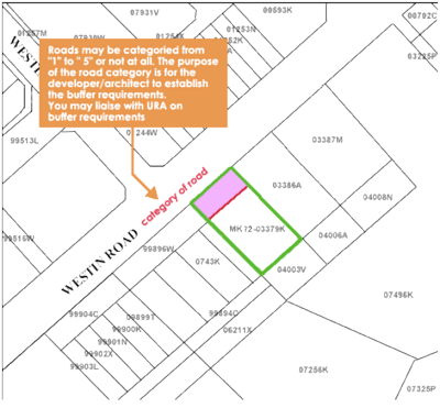
Future road reserve alignments and widths are systematically safeguarded based on various land use and transport studies. The road safeguarding information is made available to the public through Road Line Plans, which show this information graphically using cadastral data from the Land Survey Division of the Singapore Land Authority (SLA).
Road Line Plans can be obtained for current valid cadastral lots in either PDF or CAD format at SLA’s Integrated Land Information Service (INLIS) portal.


